or Call Us 1 (888) 620-6742

Researching Land

How to Sell Your Land On-Line

By: Mark Podolsky | July 21, 2012

About 15 years ago the best way to market your rural land was either a classified ad in the local paper, signage off the highway or the local pennysaver. Larger companies would use radio or some other direct marketing technique. All of these marketing strategies were slower and more expensive than the options today. I know we all like to complain about inflation but in terms of online marketing we’re in a deflationary environment!

With a little computer knowledge, we have at our disposal today the most compelling and powerful marketing platform ever created and it can be accessed from zero cost to less than $50 month.

CONTENT

Before getting started, check out a few sample ads for houses and you’ll notice that they are emphasizing the benefits and amenities of the house. Don’t sell the steak, sell the sizzle. Raw land is no different. Take a good look at what makes your land compelling. Mountain views? Water? Hunting? Recreational area? Good access? In the path of development? Trees? Then get out the thesaurus and use some colorful adjectives to describe the area and land. Of course, you will need a section for just the facts such as: elevation, access, terrain, deed conveyance, taxes, driving directions, GPS coordinates, sewer, water, utilities, mineral rights, etc. I like to use a simple table outlining all of the basic attributes and facts about the land. It is essential that the potential buyer have easy access to this basic information but it won’t help sell the land. Your language and conviction about the area need to be conveyed to a potential buyer and that is what will sell the property. More information is always better than less. Once you have your content well laid out then you need to add images.

IMAGES & MAPS

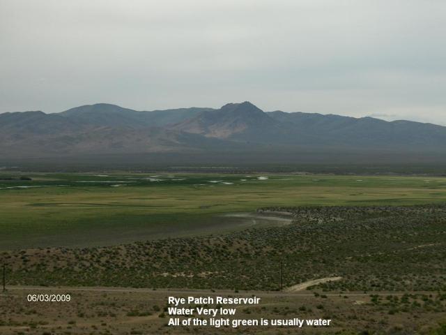
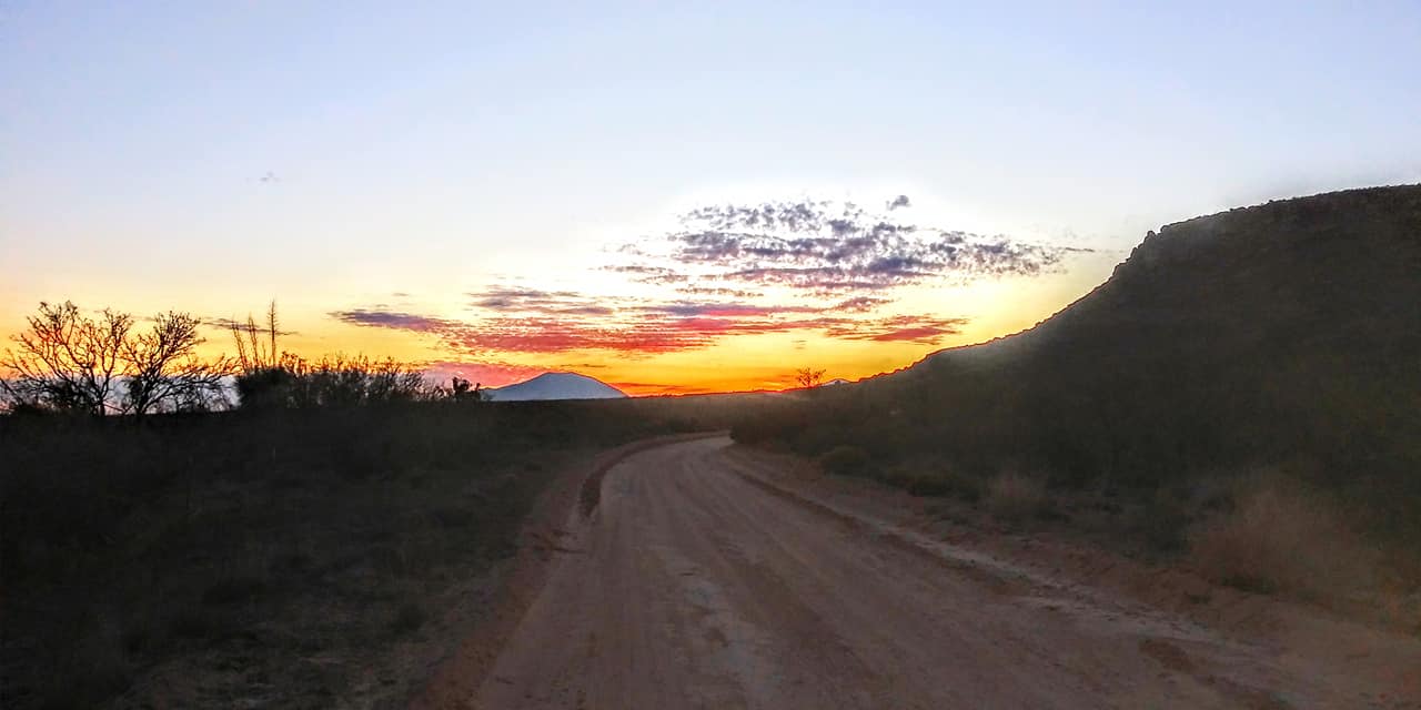
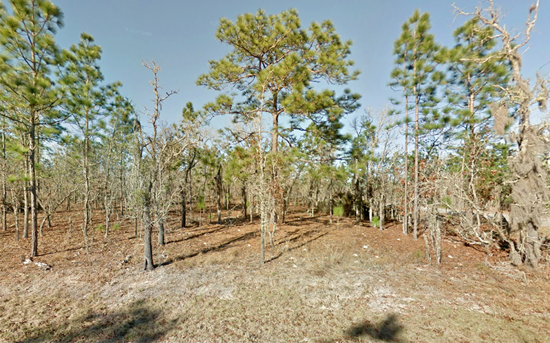
Your potential buyer needs to see more than just the words you use to describe the land. They also need to visually connect with the property via high quality maps and pictures of the parcel and surrounding area. You don’t need to have 50 pictures but you do need at least five or so to give the buyer an idea of the terrain, soil and views as well as the road of where they would access the land. You should include a plat map (call the county for a copy), general area map (I like to use Google Earth for maps) and a topographic map is always helpful as well. You can always contact a local surveyor if you need help preparing the maps and getting the GPS coordinates.

PRICING

Raw land prices are currently depressed. Be realistic about pricing. Call the County Assessor for the last two years of comparable sales and price accordingly.

FREE CLASSIFIED ADS

The best place to list free classified ads these days is craigslist.org and backpage.com These are simple no-nonsense interface sites where you can list the property price, description and add images. The big drawback is you have to continue to edit and update your listing to stay on top of the listing system otherwise it will be more difficult for buyers to find you. You can learn more about how to do this through basic Google searches.

PAID AGGREGATOR SITES

There are a few major paid aggregator sites that list land and do all the search engine optimization work for you so when someone Googles “land in California” your listings have a better chance of coming up at the top of the search results page.

Here is an example of the kind of sites that I prefer: landandfarm.com Although these sites are not free, they charge no more than $40 a month for a basic listing package which is actually cheaper than eBay and tends to fetch higher prices as eBay buyers are typically deal hunters. These sites have easy to fill out forms requesting all the basic information a buyer will want to know prior to acquiring the land. They have easy features for uploading pictures and inputting maps. Don’t expect the property to sell within the first month. However you should get some inquiries that first month and if you don’t you will want to edit and adjust your advertisement or switch aggregator sites. Once you have a link to the property you can start sharing it on social media sites like Facebook and Twitter. You just never know if a friend of a friend might be in the market for your property.

CUSTOMER SERVICE

You will need to advertise an email address and phone number for people to contact you so you can field additional questions about the property. Most often, people will want to know if the property is free and clear of any liens or encumbrances including back taxes. They will want to know if there are any other closing costs, Home Owner Association Fees and other details regarding the property. Always be direct when dealing with your customers. If you don’t know the answer simply say you don’t know and that you’ll find out or direct them to the appropriate resource. Typically a surveyor or the local county can help them with what they are looking for.

CLOSING THE DEAL

Use a title company if you are not familiar with deeds, deed conveyance and closing of real estate. I prefer First American Title and you can find them anywhere. They will handle the monies, title search, title policy, deed, recording of the deed and pro-rated taxes, etc. Fees will vary and you can certainly negotiate. Typically the seller pays for the title policy and the buyer pays for half of the escrow fees. You can always charge an extra recording fee to offset these expenses.

THIS SEEMS LIKE A HASSLE! WHAT OTHER OPTIONS ARE THERE?

If this process overwhelms you, consider hiring a land broker. A land broker will take a commission but they will handle all of the above for you. Hopefully they will price the property so that you make almost as much as you would have without hiring the land broker meanwhile it saves you a lot of time and hassle. I do not recommend working with a land broker who charges a flat upfront fee even if the property doesn’t sell as there is no built-in incentive for them to sell the property. Keep on top of them and make sure they are doing their job. Unless the commission is hefty, a land broker isn’t going to care as much about selling your land and may end up just listing it on their own website and letting it sit there forever. Communicate regularly with your land broker so your listing remains a priority for them even if it’s just to get you off their back!

The last option is to call a company like mine and field an offer. We will do all the research and make an offer (typically below market value so we can make money) and pay all the fees. If you are looking for quick and easy this option might work for you. Try it on your own first though as it’s a fun process and you’ll exercise a bunch of brain muscles in new ways. Good luck and feel free to contact me with your questions for a free 20-minute land coaching consultation.

What the Heck is a Conservation Easement?

By: Mark Podolsky | April 26, 2012


Conservation easements are powerful, effective tools available to landowners for the permanent conservation of private lands in the United States. The use of conservation easement options has successfully protected millions of acres of wildlife habitat and open space, keeping land in private hands and generating significant public benefits.


The primary purpose of a conservation easement is to give a landowner the right to protect his land from certain types of development or land use. This opportunity appeals to property owners who hold undeveloped land that is agricultural and/or has timberland, wildlife habitats, natural open space, and those with natural resources. Simply, a conservation easement is a restriction on the use of property similar to a deed restriction. It is recorded in public records and generally is in perpetuity. The government receives assurance that this valuable land will be protected from future development. 


When you purchase land, you also purchase a bundle of rights. These rights include, among others, the right to develop, and the right to minerals and water. Collectively this bundle of rights is called “fee title.”


As a landowner, you also have the ability to sell some of these rights while maintaining ownership to the land. This is generally known as selling a “less-than-fee” interest. A conservation easement is a form of “less-than fee” interest and is a voluntary agreement that allows a landowner to limit the type or amount of development on their property while retaining private ownership of the land.


While many conservation easements are donated, others are also sold. If your land qualifies as a conservation easement, it is worth your time to research how this can benefit you and your family for generations to come.


Are you making this mistake?

By: Mark Podolsky | April 20, 2012


One of the biggest mistakes I see online investors making everyday is not doing enough research on the property they are investing in!  One of the biggest mistakes they make is going out and not seeing the property for themselves. It’s a big critical mistake. Don’t misunderstand, there’s nothing wrong with buying property online site unseen. I have done it.  However, I go on Google Earth and I look at it virtually!  Still, I don’t close the deal until someone physically goes and checks on that property for me.

So how do I do it? There’s a great site out there called wegolook.com. WeGoLook.com starts at only $49.00!

Send someone else to go look at your property if you are unable to do it yourself.  Or, you can always take ask a local realtor.  Give the realtor a call and say, “Hey, I am buying this property – have you seen it?” If not, ask them to go take a look for you and you’ll gladly pay them for their time about $50-$100 to take a few pictures for you, assess the terrain, make sure there aren’t any topographical issues with the property, poor access or in a dangerous area.  

If no one can go look at it, make sure there’s a guarantee. I always offer a 90-day addition due-diligence on my property so that people can go, plan a trip, make sure that they really love the property they are buying.

Nobody wants to be disappointed in a land purchase, and as a seller, you never want that either!

Are you buying in a flood zone?

By: Mark Podolsky | February 8, 2012

Investing in raw land over the last 11 years has taught me some hard lessons. The 1st lesson, is not to trust the tax assessors database. However, I always thought that I could trust the flood designation. Unfortunately, with FEMA changing the flood designations on an annual basis this is not the case. With FEMA constantly changing the flood hazard maps, a property that may have been designated outside of a floodplain a few years ago may now actually be located within a hazardous boundary.

 So what can you do about this?  

Buying a property in a high-risk flood zone could mean additional expenses including a flood survey as well as ongoing flood insurance.  In addition to this, it could make the home more difficult to sell at some point in the future as a result of this designation (not to mention the expense and headache associated with a flooded property).  Flood insurance alone can be anywhere from a few hundred dollars a year all the way up to a few thousand a year, depending on the flood zone category. The bottom line is any property purchase should be made with full knowledge and awareness of the property’s flood zone designation.

Going forward, we have implemented a policy in my office to run official flood certifications on any new properties we put under contract. Rather than rely on our local tax database or even some of the free flood zone sites online (which we have also found to be inaccurate), we have partnered with local lenders to run this for us . We also have an insurance agent that can run flood certs as well.  Most investors have a good relationship with either an insurance agent or loan officer that would be willing to help in this area – don’t be afraid to utilize these relationships for this valuable information.

As an aside, if you do discover that a property you have purchased is in a flood plain, consider carefully what kind of flood insurance coverage you want. It may be that your lender requires flood insurance, but doesn’t necessarily dictate how much coverage you need. If this is the case and you feel confident that the property won’t flood, you may be able to elect to cover only the building (not contents), insure for a lesser dollar amount, or carry a higher deductible. In doing so, you can lessen the impact that flood insurance has on your cash flow by obtaining a policy with a smaller yearly premium.

For more information on the National Flood Insurance Program, check out the official government website at FloodSmart.gov. But even more importantly, make sure you have the ability to determine the flood zone of a property before you buy it. The last thing a real estate investor wants is a property with unexpected risk and expenses cutting into future profit.

How I Leverage Technology To Get More Deals Done

By: Mark Podolsky | January 26, 2012

Being a land geek has its advantages. I have been able to leverage technology to be able to get twice as much done to focus on deals and not be bogged down by paperwork, mailings and flying on planes to research land.

We are in the Golden age of real estate investing. It used to be a slow and arduous process to get a deal done just because of all the due diligence and paperwork involved.  Today, using technology I have found five great web sites and services to allow me to focus on what is going to make me money… Closing deals.

The first website I utilize on an almost daily basis is www.docusign.com. Whether you are a realtor or real estate investor, docusign is an invaluable resource when you have to get your customers to sign on the line that is dotted. What used to take several days in document preparation, regular mail or FedEx and their associated costs I can now do in a matter of minutes.  Plus, the future of computing is mobile phones and tablets. Docusign allows me to view, sign and edit my  documents on the iPad, iPhone or an Android phone. Plus, the monthly fee is small compared to the monthly FedEx fees I had to incur in sending my contract out to my various customers throughout the country.  The turnaround time is instant and the dream of a paperless office is now a reality with services like Docusign.com.

the 2nd website I find invaluable is a map making site www.expertgps.com. Oftentimes, I used to have to rely on a professional surveyor to create a map for me to show my online customers the GPS coordinates of the property,  the driving directions to that property and the topographic features of that parcel. Instead of paying a surveyor over $100 an hour to prepare these complex maps  I now utilize a $200 software program named www.expertGPS.com.   by simply typing in the Township Section and Range of a property, expert GPS will create a map for me.  It works in conjunction with Google Earth and I can then manipulate that map several ways to show my customer the driving directions, the GPS coordinates as well as the topographic features of the property. What used to cost money and time in map making now literally can be prepared in minutes. In fact,  I have created a 3 part video series for my land geek coaching clients to teach them how to create these maps online using expert GPS.com in conjunction with Google Earth.

Another great time-saving website I have found is www.simplecertifiedmail.com.  When need to get someone’s attention, a great way to do that is to send them certified mail. Unfortunately, when my note clients are late on their payments I find that certified mail is an effective way to get their attention in order for my note payment to become a priority. However, it’s a pain  to have to drive to the Post Office,  stand in line, and then hand write a certified mail label. For a small fee, simplecertified mail.com allows me to print by certified mail postage online and they provide the certified mail envelopes and I can even track when my recipient receives their certified letter. This wonderful online service saves me time and gas not to mention the frustration of waiting in long Post Office lines!   If time is money, then you really owe it to yourself to check out www.simplecertifiedmail.com.

The fourth time saving website I have found extremely useful for my due diligence is a new service called www.wegolook.com.     I always tell people never acquire property sight unseen. Yet, I often have to buy property sight unseen because even using Google Earth and all the tech tools at my disposal nothing replaces a human being going out and stomping on the property. However, to save me time and money and allow me to do deals throughout the country I utilize the people at www.wegolook.com to go and find the property, take pictures for me and basically do a phase 1 inspection of the property. If the people at www.wegolook.com can’t find the property, then most likely my potential buyers won’t either and that is a good indication that no matter how fantastic the deal looks I should pass on it.   Plus, the service is ridiculously inexpensive starting at only $49.

The last service I use is like a de facto escrow company for me. When dealing with inexpensive raw land, sometimes I will simply do a title search on my own and save the money using the title company and an escrow service. The way I do this is utilizing a company online named www.notarypro.com.   For example,  I send an offer letter to a potential seller whom then accepts the offer.   Using expertGPS.com and Google Earth as well as wegolook.com I thoroughly research the property and discover that it’s a fantastic buy. So to close the deal, I send all of the documents to the notary, they set up a time with my seller whom then signs over the property to my company.  The notary notarizes their signature, gives the seller a cashiers check and then sends back all the documents to me. As a result, I save money on escrow fees and my seller gets a quick close.  Moreover,  I have a faster turnaround time as well with all of the paperwork. I have found this way of closing deals safe, effective and my sellers love it.

Have I missed an excellent website?   Please leave me a comment on how you use technology to either research transactions, close transactions or just save time and money.


3 Questions To Ask Yourself Before Investing In Any Property

By: Mark Podolsky | January 23, 2012

 Oftentimes I have noticed the average investor doesn’t ask themselves the 3 most important questions before investing any piece of property.   Usually, they get emotionally involved in the imaginative issues with the property. They can see it as a wonderful homestead or a refuge from their busy lives. Yet, before jumping in feet first you should ask yourself these 3 questions:

1. Are the taxes low enough on this piece of property so if my circumstances change and I can’t for whatever reason be able to accomplish my initial goals that I have for this piece of property is it going to affect me negatively in the long run?

You never want to get stuck with a piece of property that could become a liability for you and not an asset. Land can be a great long-term investment, but it can take many years for that piece of property to appreciate in value and each year you have to pay the taxes on that piece of property. If the taxes are so high that it’s going to become a financial burden and as a result you may one day have to liquidate that piece of property at a loss, then the whole purpose for buying the property has been wasted.   I love rural property simply because of its natural beauty, the open spaces, the privacy associated with it and the lack of restrictions. Nevertheless, I can hold on to that piece of property for many years without it becoming a financial burden simply because rural property typically has a lower tax basis than an already improved piece of property. 

2.  What is compelling about this piece of property?

Before I invest in any piece of property I ask myself what is so compelling about this property that if I had to sell it tomorrow to another buyer they would also find the same attributes about the land compelling. For example,  am I buying this property because of its natural beauty? Does it have mountain views, or is it near a lake or major body of water? Am I near a large city that is growing or has many amenities that most people would enjoy? Is there a creek running through the property or am I in the path of growth? Can I farm this land or is the terrain a perfect place for recreational use? That is, don’t invest in the property simply because it seems like it’s a great deal. If price is the first and only consideration, you may be making a huge financial mistake because ultimately that property will  go up in value and if there is not something compelling about that property to another buyer you could simply be stuck with it. 

3. How do I know I’m not overpaying for this piece of property?  

Determining what you should pay for a piece of property as is often trickier with raw land than it is for a home or apartment building. With housing it’s very easy to look up the comparable sales in the neighborhood and see what most people are paying and what range. However, with raw land there are so many factors that come into play that each piece of land needs to be evaluated on its own merit. Typically, you need to first determine what your highest and best use for that piece of property is going to be. If you are planning on building on that piece of property what are the costs that are going to be associated with that? How much to install a well? Do you need to blade roads? How much to  tap into power or go solar? What will that cost? Any improvements you make to the property need to be factored in to the total cost of the investment. Then, you need to contact the local realtors and see what similar pieces of property are selling for in the same area.  Maybe another seller has already made the improvements that you are interested in and you can get it for a better price and fewer headaches.  After you do all this analysis, you should get a good idea of what you should pay for this piece of property. If the seller is not realistic about the price, let them know during your negotiations why you think the property is overpriced before you make that low ball offer.   Another place to look  is Craigslist and see what people are selling their lots for on a for sale by owner basis. If you notice that the property you are interested in is higher than the for sale by owner listings on Craigslist that’s a good indication you may be overpaying for that piece of property although again each piece of property is different and you have to look at each unique attribute of that property.

Asking yourself these 3 important questions before making any land investment is going to save you  money and is going to make you a much more sophisticated land investor.

If you found these 3 questions helpful in your land search leave me a comment.  

Why is this land so cheap? What’s the Catch!

By: Mark Podolsky | August 18, 2011

 I grew up hearing this expression all the time, “If it sounds too good to be true then it probably is…”  We all know what it feels like to get ripped off either by over-paying for something or under-paying and it doesn’t work.  This fear serves us well.   However, in the land business you have to be especially careful of “deals.”  Doing your homework is the only way you’re going to know if it’s a deal or a problem.  Almost daily, someone sees some of the inexpensive land I’m selling online and wants to know the catch.   Usually, the only catch is I bought it right and I’m quickly flipping for a quick wholesale gain.  Sometimes, it’s just simply supply demand where there is just so much rural land you have to price competitively.   I think you should always be more cautious and less trusting online and ask the seller a ton of questions prior to any acquisition.  It’s the only way you’ll be more certain that your deal is really a deal and not some scam.  The good news is, with Facebook and Twitter the days of a land seller taking advantage of people with shady transactions are numbered.  It’s just too easy now to have your reputation destroyed over night by one bad deal to one customer.   The old adage of buyer beware is here to stay, but suddenly the tables are turning…

Avoiding buyer’s remorse:

Nevertheless, once you determine you’re getting a great “buy” make sure you are clear on why you’re investing in the property prior to your investment.   If your main intention is to one day retire on the property and build be certain you have talked to the local Planning & Zoning board and discuss your plans.  Maybe what you want to do is not allowed.   If you want to raise horses or goats same thing.   If you’re just buying as your legacy to your family one day then obviously the research doesn’t need to be as exhaustive.  Just make sure that all of your questions have been answered sufficiently before pulling the trigger on your land purchase.

If you have a land buying story you want to share with me feel free to do so in the comments or by sending me a message.

What the Hell are Water Rights?

By: Mark Podolsky | May 11, 2011

Billionaire T. Boone Pickens can’t buy water rights fast enough.  Check out this article.  Pickens is quoted as saying,  “I know what people say – water’s a lot like air. Do you charge for air? ’Course not; you shouldn’t charge for water,” says he. “Well, OK, watch what happens. You won’t have any water.”

Water rights in water law refers to the right of a user to use water from a water source, e.g., a river, stream, pond or source of groundwater. In areas with plentiful water and few users, such systems are generally not complicated or contentious. In other areas, especially arid areas where irrigation is practiced, such systems are often the source of conflict, both legal and physical. Some systems treat surface water and ground water in the same manner, while others use different principles for each.

Water rights in the United States

In the United States, there are two divergent systems for determining water rights. Riparian water rights (derived from English common law) are common in the east and prior appropriation water rights (developed in Colorado and California) are common in the west. Each state has its own variations on these basic principles, as informed by custom, culture, geography, legislation and case law. California law, for example, includes elements of both systems. In general, a water right is established by obtaining an authorization from the state in the form of a water right permit. A legal right is formally consummated, or perfected, by exercising the water right permit and using the water for a beneficial purpose.

Under the prior appropriation doctrine, water rights are “first in time, first in right.” That is, the older, or senior, water right may operate to the exclusion of junior water rights. The concept of “priority date” is significant. The priority date is generally associated with the date that water was first put to beneficial use, or the date that a successful application for a water right was submitted, and indicates the relative status of seniority among competing users. Older rights are senior. More recent rights are junior.

Water rights are generally established pursuant to State law, but there are exceptions, most notably, the concept of federal reserved water rights. Reserved water rights are rights that are established when the federal government reserves land for a specific federal purpose. Courts have held that there is an implied water right to satisfy the primary purposes of the reservation. Examples of reservations include Indian reservations, national wildlife refuges, federal forests and military bases.

Proceedings to determine the relative priority of claims to water rights are known as adjudications. Through Congress’s passage of the McCarren amendment, the federal government has consented to having its claims adjudicated in state courts.

All states offer mechanisms for changing how a water right is exercised, e.g., amending the point of diversion or withdrawal, the place of use and the purpose of use. In reviewing such requests, the state must guard against the impairment of other water rights, the enlargement of the water right and injury to the public interest.

Resolution of Interstate Water Conflicts

Because water bodies may cross political and jurisdictional boundaries, conflicts may arise. In the United States, three basic approaches are used to settle such conflicts: 1) Litigation before the Supreme Court of the United States; 2) Legislative resolution by the Congress of the United States; and 3) Negotiation and ratification of interstate compacts between states. [3] In the western United States, for example, the 1922 Colorado River Compact divides the Colorado River basin into two areas, the Upper Division (comprising Colorado, New Mexico, Utah and Wyoming) and the Lower Division (Nevada, Arizona and California). A comprehensive review of existing interstate water compacts has been published by the Model Interstate Water Compact Project at the University of New Mexico School of Law’s Utton Transboundary Resource Center.[4]

Limitations on water rights

In California, courts have held that appropriation water rights may be limited under the public trust doctrine, a common law principle recognized by some courts, which holds that the public has access rights upon navigable waters and that navigable waters are held in trust for the use of the people. The public trust doctrine was invoked by the California Supreme Court in a case restricting the amount of water Los Angeles could divert from tributaries of Mono Lake. The case was filed by the Audubon Society and the Mono Lake Committee.

In the United States, Navigable waters are subject to the commerce clause of the U.S. Constitution. The commerce clause provides the federal government the ability to restrict state issued water rights via, for example, the enforcement of water quality standards via the Federal Water Pollution Control Act (Clean Water Act), the Federal Power Act and the protection of endangered species via the Endangered Species Act.

I know this is all fascinating stuff, but basically if you’re interested in building in a rural area get to know the States stance and procedures for water rights.


What the hell is a perc test?

By: Mark Podolsky | April 28, 2011

percolation test (from percolation, colloquially called a perc test) is a test to determine the absorption rate of soil for a septic drain field or “leach field”. The results of a percolation test are required to properly design a septic system. In its broadest terms, percolation testing is simply observing how quickly a known volume of water dissipates into the subsoil of a drilled hole of a known surface area. While every jurisdiction will have its own laws regarding the exact calculations for the length of line, depth of pit, etc., the testing procedures are the same.

In general, sandy soil will absorb more water than soil with a high concentration of clay or where the water table is close to the surface.

Testing method

A percolation test consists of digging one or more holes in the soil of the proposed leach field to a specified depth, presoaking the holes by maintaining a high water level in the holes, then running the test by filling the holes to a specific level and timing the drop of the water level as the water percolates into the surrounding soil. There are various empirical formulae for determining the required size of a leach field based on the size of facility, the percolation test results, and other parameters.

For leach line testing (the most common type throughout most of the country), a minimum of three test holes are drilled, most commonly six to eight inches in diameter. Ideally, these should be drilled to different depths from three to six feet below the surface. For better, more conclusive results, five drill holes are used in a pattern of one hole at each corner of the proposed leach field and one test hole in the center. Testing of these holes will result in a value with units of minutes per inch. This value is then correlated to a predetermined county health code to establish the exact size of the leach field.

Testing for horizontal pits typically requires five to eight test holes drilled in a straight line, or along a common contour, from three to ten feet below the surface. Testing is identical to leach line testing, though the end result is a different type of septic system, established through a different calculation.

Vertical seepage pits are slightly different in testing methods due to their large size, but the basic testing method is essentially the same. A hole, typically three to four feet in diameter is drilled to a depth of twenty or thirty feet (depending on the local groundwater table), and a fire hose is used to fill the pit as quickly as possible, and then, again, its dissipation rate is observed. This rate is used to calculate the size and number of pits necessary for a viable septic system.

Finally, for leach line systems and horizontal seepage pits, a “deep hole” is drilled to find the water table or to approximately twelve feet (dry). Exact depths will again depend on local health codes. In the case of a vertical seepage pit, local groundwater data may be used, or if the drill hole reaches groundwater, the pit will be backfilled again according to county health codes.

Septic System

I know thrilling stuff right?  Well, when you are building your toilet for your rural land you’ll want to make sure that your soil percs….  If you want to learn more about septic systems click here


We’re Here to Help! Let’s Get Started
We really wanted to hear from you, we can guide you step by step.
get in touch now